Showing posts with label Fryeburg. Show all posts

Tuesday, December 01, 2020

DELIVERING FOR HELEN


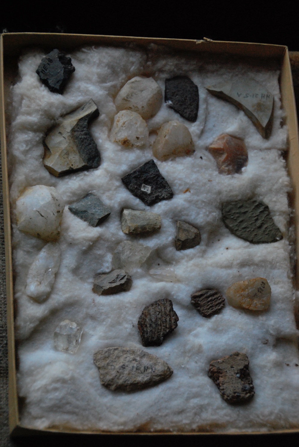
Last week I took a load off my truck and off my mind. I delivered all the late Helen Leadbeater’s Indian artifacts and journals to the Maine State Museum in Augusta. The boxes I had packed up last summer filled my Toyota Tacoma. They comprised the result of thirty years of collecting and documenting Indian artifacts from the upper Saco River Valley. I was afraid my truck wasn’t big enough to fit it all in. I was also afraid all that stone weighed so much I might break a spring, but I made it.


There to greet me were Arthur Speiss, senior archaeologist at the Maine Historic Preservation Commission, and Paula Work of the Museum. When I asked Paula what was so valuable about Helen’s collection, she said there had been hardly any professional archaeological work done in my part of Maine and, though Helen wasn’t a professional, she was a very careful researcher who kept extensive records of what she found and where.


Though my tenure here in western Maine overlapped Helen’s, we never met. My sister-in-law collected with her in North Fryeburg’s fields after they were plowed and harrowed in springtime. My brother viewed the collection after being granted access by Helen’s son, Arizona Zipper, who inherited her property across from Fryeburg Academy. When I wrote about Helen’s collection in this column, AZ, as Arizona Zipper likes to be called, knocked on my door and invited me to see it as well.


That was ten years ago when I was still teaching US History in Fryeburg. Virtually every archaeologist in the northeast had made the pilgrimage to Helen’s house, and one of them, Mike Gramly, asked me to inventory the collection for him. Gramly used to head up the Maine State Museum and the IRS recognizes him as an appraiser of archaeological collections like Helen’s. So, when I retired that became my first project. AZ gave me access again and I spent three weeks that first winter of retirement photographing her artifacts the way Gramly asked me to.


A local woman named Diana Bell heard about what I was doing and offered her assistance. While I photographed the artifacts box by box (Helen used hundreds of nylon stocking boxes to store them in), Diana scanned Helen’s notebooks and journals, which were also extensive. Thus I learned much about early human settlement of Fryeburg, Lovell, and Conway, New Hampshire. Helen published one scholarly article on pottery in the Maine Archaeological Society Journal in 1978.


A former student of mine named Bill Rombola had surveyed Helen’s collection during his archaeological study at the University of Southern Maine and published another article about in the journal in 1998. In it, Rombola reported that some of Helen’s artifacts were as much as 8000-9000 years old and were made from lithic (stone) material from New York, Vermont, Maine, Quebec and even northern Labrador (Ramah Chert).


AZ had little interest in his mother’s passion but he respected her work and wished to preserve it for study. His house is huge, difficult to heat and maintain, so for years he’s been considering a sale and a move to a smaller home. At one point, I was working with Dan Lee, former headmaster at Fryeburg Academy, to mediate a purchase of the home and turn part of it into a museum for Helen’t collection. AZ couldn’t pull the trigger on that so I began trying to convince him to let the Maine State Museum have the collection.


Last spring, he agreed under one condition: that photographs of Helen’s artifacts and digital copies of her journals be made available online as well as at the museum. I hurried to get his signature on a formal agreement to that effect from the museum and began to box up the collection. That occupied me last summer through some very hot, humid weeks getting it all packed and moved to a friend’s garage in Lovell. I also retrieved several boxes of artifacts that had been on loan to the Conway Library for exhibit.


Helen Leadbeater

In Augusta last week, Art and Paula helped me unload, and Paula showed me around the museum warehouse. I was thoroughly fascinated as only a history geek could be. On its moveable shelves were every historical collection about which I had been reading for decades! At one point we passed a drawer labeled “Michaud” which I knew to be a paleoindian site in Auburn, Maine. She pulled it out and let me hold a paleo projectile point over 12 thousand years old. It was quite a thrill. I said I wished I didn’t live so far away because I could spend months there totally enthralled. She said I’d be welcome anytime.


Saturday, September 19, 2020

THE FRYEBURG CANAL ON THE SACO RIVER


Promotion for Barrows' book on Fryeburg History 1938

Exactly two hundred years ago, a group of local farmers in Fryeburg, Maine changed the course of the Saco River with oxen and hand tools. First, however, they had to dig through bureaucratic red tape put in their path by Massachusetts government from which they requested help. Frustrated by that and the state’s refusal of funds, they dug a canal by themselves at their own expense. It was completed in 1820, the same year Maine finally broke from Massachusetts and became its own state.

North Fryeburg farmland today

After rising near Crawford Notch in New Hampshire, the Saco River enters Maine in Fryeburg. Although the town is only about ten miles square, the Saco meanders through it for thirty-six miles. Early settlers cleared land and farmed, but the most fertile land in the northern part of town flooded nearly every spring. It was so bad, farmers petitioned the Massachusetts legislature (which governed Maine at the time) for flood relief in 1786. For the loss of a grist mill, nine houses, numerous animals, and much produce, Fryeburg was granted a tax abatement of 200 pounds. 

Saco River today

That was temporary relief and farmers wanted something permanent. They next petitioned the Massachusetts to fund a canal for flood control in 1812. They had a good idea about where and how to dig it because at one point near the center of town, the meandering courses of the river were only four-and-a-half miles apart. A canal there, through mostly sandy soil, would cut off seventeen miles of river through the fertile intervale in north Fryeburg. The plan was sound and would eventually relieve much of the flooding, but Massachusetts would not give them any money — only permission. So farmers wanted to dig it on their own.


More rich North Fryeburg farmland

First, however, they had to indemnify themselves against legal liability for whatever damages their canal might cause, for along with state permission to form a corporation called “Proprietors of the Fryeburg(h) Canal,” the state attached — to both the corporation and three dozen individual proprietors — legal responsibility for damages in perpetuity. So, the farmers went back to the state in February, 1816 for relief of this endless liability. Massachusetts responded in June, 1816 by limiting it to four years. Only then did the farmers feel safe enough to break ground in earnest.


Old River upstream from Hemlock Bridge

The sequence of actual construction is a bit confusing to this writer. One account said the digging of the first phase began in 1812; others say the digging began 1816 or 1817, but all agree the canal was finished in 1820 with the assistance of Mother Nature. It’s hard to say exactly where that construction started and some say it was done in segments over an eight-year period between 1812 and 1820. The most comprehensive account I have found so far is in John Stuart Barrow’s Fryeburg, Maine: An Historical Sketch published in 1938.


Fryeburg before canal showing two ponds in the center
Library of Congress map

There were two ponds within the four-and-a-half-mile stretch of land across which the canal was planned. One, called Bear Pond, was situated about where Canal Bridge crosses the present course of the river and it was completely drained by the canal. Nothing is left. The other, called Bog Pond, was larger and the canal drained most of it too, but a small segment remains to this day off Bog Pond Road between Route 5 and Menotomy Road.


Old Course of Saco near Hemlock Bridge

According to former Fryeburg Historical Society President Diane Jones, the digging began behind what is now the Al Barton farm in West Fryeburg. She told me her late husband, Ed Jones, together with the late Phil Andrews, found what they believed was the beginning of the canal. None of the many accounts I read about or heard about contradict this. For those who said the first segment was dug between what is now the Old Course of the Saco and Bear Pond, the Jones/Andrews claim is as good as any about exactly where. I went down there last week, but vegetation is so thick in the many old oxbow riverbeds, I could see little. I’ll go back after leaf drop in the fall and check it out again.


Old Course of the Saco in Fryeburg Harbor

Canal construction began with a narrow ditch — either in 1812 or in 1816 — and leading into Bear Pond. One account from Bill Vinton of Lovell said that a man could step across it in certain sections. Then came a freshet (river flooding) in 1820 that widened the ditch into the wider canal we see now and drained Bear Pond, then proceeded to Bog Pond and beyond to connect where the main course of the river below Hemlock Bridge now flows. Another account says there were two separate phases and the second phase was dug between the ponds a few years after the Bear Pond phase, and the 1820 freshet widened and deepened that part as well to complete the course of the Saco River as we know it today.


From Canal Bridge where Bear Pond used to be

Today’s course is the river with a sandy bottom so many canoers enjoy. There’s little water left now in the Old Course of the Saco — which is what the 17 miles of river cut off by the canal has been called. There is more water where tributaries still flow in but not enough to use a canoe or kayak until the “Fryeburg Harbor” area where the Cold River flows in from Stow and the Kezar Lake outlet enters from Lovell. Even there the old river is slow-moving and choked with weeds, especially in late summer. Snapping turtles like it and they grow very large, but no one would want to float a tube or swim in it.


Winter dawn on today's Saco River

Indians had traveled the winding Saco River in Fryeburg, possibly for nine thousand years or more. Archaeologists believe they farmed its fertile, intervale planting corn, beans, and squash beginning about three thousand years ago. In the late 20th century, amateur archaeologist Helen Leadbeater excavated two significant Indian settlements, one at Fryeburg Harbor and the other at Lovewell’s Pond. That pond is only a short canoe ride from the Saco as it flows south out of Fryeburg at the southern end end of town. She amassed her huge artifact collection primarily from these two sites.


She also investigated the entire shore of Lovewell’s Pond and, based on the patterns of where she found artifacts, she surmised that Indians often portaged across a two-mile stretch of what is now Fryeburg Village from the Weston’s Bridge area to the northern shore of the pond. That shortcut would eliminate about two dozen miles of paddling through north Fryeburg for those traveling express from settlements in Conway, New Hampshire to other encampments along the river’s course all the way to its mouth in what is now Saco/Biddeford. 


There are many different spellings of Pequawket

The Pequawkets were part of a subgroup of Abenaki Indians called Sokokis who settled Fryeburg in historic times. They also included the Ossipee, after whom both the town in New Hampshire and a tributary of the Saco flowing from the Ossipee area are named. The Pequawkets and the Ossipee traveled up and down the rivers between the coast and the White Mountains regularly. Captain John Smith and Samuel Champlain both had contact with the Sokokis at the Saco River’s mouth in the early 1600s. The section of Maine’s Route 5 between the Fryeburg/Brownfield area and Saco, Maine is still called the “Sokokis Trail.”


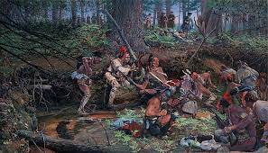
The first white man thought to have entered what is now Fryeburg was likely Darby Field in 1642 on his way to Mount Washington. He described an Indian village of about two hundred and was probably referring to Pequawket — now Fryeburg. We know Captain John Lovewell arrived in 1725 from Dunstable, Massachusetts to fight Pequawket Indians at the pond named for him. Some historians claim Lovewell came to take Indian scalps, but other sources say he was retaliating for Pequawket raids into Dunstable and nearby Andover, Massachusetts. Lovewell died battling Indians in Fryeburg after which most of the Pequawkets retreated to St. Francis on the St Lawrence River.


John Buxton's "Ambush at Lovewell's Pond"

The man destined to have the most impact on Fryeburg was Colonel Joseph Frye of Andover, after whom Fryeburg is named. A surveyor by trade, he knew of the fertile Saco intervale the Indians prized and persuaded the Province of Massachusetts to grant him the land in return for his service in the French and Indian War.


Cumberland and Oxford Canal

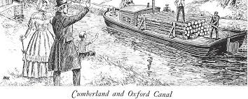
During the late 1700s and early 1800s centuries there was a lot of canal digging in Maine and New England, mostly for two purposes: transportation and power. The Saco River canal for flood control was relatively unusual at the time. As it was completed though, a huge transportation canal project nearby was being planned called the Cumberland and Oxford Canal which was opened to traffic in 1832 from the outlet of Sebago Lake to Portland Harbor on the coast. Canals for water power were dug along the Androscoggin River in Lewiston for powering its textile mills.


Back in the 1970s an older Lovell, Maine citizen told me how her grandfather shipped barrels of apples to England from Lovell in the 1800s. First he took them by wagon over the hills of Sweden, Maine to the northern tip of Long Lake in Harrison Village. There they were loaded onto specialized canal boats for transport down Long Lake, through the Songo Lock to Sebago Lake, then across it into the Cumberland and Oxford canal on the lake’s southern end. From there it was onward to inner Portland Harbor at Stroudwater.


There the apple barrels could be loaded onto ships bound for England, or they could remain on the specialized canal boats for transport along the Atlantic seaboard to the Port of Boston. These specialized canal boats were designed to drop a keel and erect two hinged masts, enabling travel along the coast in good weather.


When coal-driven steam power was introduced, however, both the power function and transportation function were gradually undermined. Steam power made railroads possible and they proved cheaper and faster than transporting goods by canal. Steam power also replaced water power for mills of all kinds: saw mills, grist mills, fulling mills, and textile mills. In Lewiston, water-driven turbines were replaced by steam turbines.


Recent shot of Saco at flood stage near Canal Bridge

The Saco River was the biggest obstacle to travel between the old settlements of Fryeburg, Maine (1763) and Bethel, Maine (1769) over an Indian trail which, today, Route 5 largely follows. Bethel is located on the Androscoggin River; Fryeburg on the Saco. Indians preferred rivers for transportation, but they sometimes traveled overland between river systems. Excellent farmland on the intervales of both rivers which first drew Indians, then attracted Bethel’s and Fryeburg’s early white settlers, Colonel Frye being one of these.


Frye had fought Indians and their French Allies in 1757 at the Battle of Fort William Henry and elsewhere as commander of the Massachusetts Militia during the French and Indian War. For that, he obtained a land grant now comprising the town bearing his name. Like fellow French and Indian War Colonel George Washington, he was surveyor by trade. Both also became generals when the American Revolution broke out, but Frye, being much older, saw little service in it compared to Washington.


Joseph Frye cellar hole today

It Massachusetts made its grant to Frye in 1762, he built his home in the center of town just above the Saco’s intervale. All that’s left of it now is a cellar hole in the woods at the end of a dirt road just off Route 5 north of the Fryeburg Fairgrounds. The road is marked by a brass plate set in a stone beside the paved highway. Frye knew the Saco intervale’s rich soil and huge potential for farming when he sought to acquire his land grant, but apparently not so much about the regularity of its annual floods and the bane they would be to farmers.


He soon learned after settling there himself but he died in 1794 before the canal was dug. He’s buried in the Village Cemetery but other members of his family lived to see the canal completed in 1820 — very close to his original home on Frye’s Hill. The Fryeburg canal stopped much of the flooding in north Fryeburg, but didn’t eliminate it entirely. I can remember twice that my brother Dan, when living on the McNeil Road in North Fryeburg at the edge of the intervale, had to use a canoe to get around for a few days.


Wednesday, September 02, 2020

THE STONE


The Stone

Last week, I picked up a piece of stone from the ground in Fryeburg, Maine where a machine of some sort had cut into an old riverbank. It was unlike any other stones around it because it came from a cave on Mount Jasper in Berlin, New Hampshire forty-five miles away. Archaeologists and geologists call it “Mount Jasper Rhyolite” and Indians mined it for about 12,000 years or more.

In the hands of a skilled “knapper,” the stone can be fashioned into various tools useful to Indians who hadn’t learned to use metals here in what is now the United States. Everyone is familiar with arrowheads or spearpoints but probably wouldn’t recognize other artifacts that are much more common wherever Indians lived and worked, sometimes only seasonally, during prehistoric times in what is now Fryeburg.


What I picked up is a scraper. It was used, probably by a woman, for various purposes — most likely to prepare hides from animals brought to camp by hunters who used those other tools archaeologists call “projectile points.” There was no way for me to figure out how long the scraper had been there. It could have been used as recently as four or five hundred years ago, or it might have been used 10,000 years ago or more. Scraper technology hadn’t changed much over ten millennia.


Early Paleolithic type projectile point


Projectile point technology, however, had. I cannot say it advanced because there’s little agreement about that. We do know that it changed. The shapes of projectile points varied over millennia, but their function remained the same. They were hafted onto either an arrow, a spear, or a dart, but the hafts — and whatever material was used to attach the point to the haft — had long ago deteriorated. With relatively rare exceptions, only stone artifacts remain to be found here in the 21st century.


Calcine bone from the site


Those exceptions include something called “calcine bone.” Unless heated, bone will deteriorate quickly. When it’s heated sufficiently during the cooking process, it turns into calcine bone and can be preserved underground under certain conditions for millennia. Another exception is pottery. Though I didn’t find any yet at the site mentioned above, I’ve found many fragments a few miles away alongside the old riverbed. Archaeologists generally agree that American Indians learned to make pottery only about 3000 years ago at the beginning of the “ceramic age.”


Damariscotta Shell Heap


One more exception would include coastal sites where human and animal bone has been preserved under shell heaps, which are fairly common along the coast of Maine and the Maritime provinces of Canada. Bones going back a few millennia have been found under discarded shells of oysters and other shellfish. Some shell heaps like those found in Damariscotta, Maine can be quite large.


The Fryeburg site is new to me and I learned of it while reading notes and journals of the late Helen Leadbeater whose extensive artifact collection I’m packing up for delivery to the Maine State Museum soon. Although she didn’t say she collected there, she referred to others who had. It’s not ethical for me to disclose the exact location of any archaeological sites and I’ve pledged not to.


Though I’m tempted to scrape away at the raised riverbank where I found these artifacts to look for more, I resist. If I were to do so, I’d be obligated to conduct a dig according to strict archaeological guidelines which I have neither the time nor the inclination to undertake. I’m content to walk around and surface-collect and then figure out where the stone from which the artifacts were made originated.


This interests me. It’s a thrill to pick up something that hadn’t been touched by another human for hundreds or thousands of years. It’s also interesting to speculate about how the unusual stone — called “exotic” by archaeologists when the source is hundreds of miles away — got to where I discovered it. The Mount Jasper rhyolite came from Berlin, NH forty-five miles away as stated, but Berlin is on the Androscoggin River, but I was collecting on the bank of an old channel of the Saco River.


Inside the cave at Mount Jasper


I also found small flakes of of the same stone as the scraper which indicated that tools were manufactured on the site, or sharpened at least. These are clues about whether Indians habitually used the site or if it were a temporary encampment. Also visible were what archaeologists call “fire-cracked rock” which are associated with hearths. Indians used river cobbles to surround fire pits the same way campers do it today. Continued use of the same hearth caused the stones to redden and crack.


All this fascinates a history geek like me and I’ll definitely return to the site as time permits to see what else turns up.


Thursday, November 14, 2019

What's Under There?


Remember digging a hole at the beach with your pail and shovel? It’s pretty easy to dig in sand when its grains are held together somewhat by moisture. Dig down far enough though and the hole fills with water. Then its sides collapse and you end up with a shallow depression. Well, that’s something like what we found when replacing a 35-year-old foundation that had been heaving up under a large garage on one of the properties I manage. First, we moved the garage off to the side. Then Colin Micklon and his crew at Micklon Tree and Landscaping dug out the old foundation which had been built on blue clay at the bottom of a hill near Kezar Lake.

Hitting blue clay
Colin got down to an undisturbed level, or “virgin ground,” as it’s called in the trade. Then he set up a pump to suck out accumulating groundwater, trucked away all the fill, and got ready to build a crushed-stone base for the new foundation. Then a nor’easter arrived last month with all that rain. On top of groundwater from several springs in the hillside, it was too much and the blue-clay sides of the hole sloughed back in. While Colin and his crew dealt with that, I consulted my research materials to understand why the blue clay was there.


Whenever I see an excavator or backhoe digging, I pull over and look in the hole. It’s the only way to see what is under the surface, right? That’s basically what geologists do when compiling data on what they call Maine’s “surficial geology.” About fifteen ago I purchased several sets of data from the Maine Geological Survey (MGS) on Lovell and the surrounding area. The MGS arranges its research to correspond with green quadrangle maps from the United States Geological Survey (USGS) you’ve probably seen hanging up in various places.

USGS map Center Lovell Quadrangle
My house is located on the southwest corner of the green map called the “Center Lovell Quadrangle.” Surrounding that are the Fryeburg Quadrangle, the Pleasant Mountain Quadrangle, the North Waterford Quadrangle, and so forth. I purchased those about forty years ago when I first moved to Lovell. I used them in my classroom to teach local geography, to guide me in my deer-hunting expeditions, and to explore cellar holes in abandoned settlements all around the area. The University of New Hampshire has an online collection of USGS Maps going back to the 1890s.


Those maps are great for seeing what is on the surface like old logging roads, jeep trails, elevations, streams, and so forth, but don’t offer any information about what is under the surface. The Maine Geological Survey (MGS) surficial geology maps I purchased were based on data compiled up to 2002, but they’ve since been updated. Teams of state geologists visit each quadrangle periodically and look into whatever excavations are going on at the time, gravel pits, cellar holes, road cuts — wherever they can get peeks underground. They compare visible data with evolving theories about which of at least four ice sheets to have come and gone over this area during the past two million+ years did what.


After purchasing fourteen acres on Lovell’s Christian Hill back in 1980 or so, we began building the house in which we now live. First I cleared the trees, then hired Tommy Barker to dig the cellar hole. (Colin was in kindergarten then.) There’s only a foot or so of topsoil above what’s called “hardpan,” which goes about fifty feet down to bedrock. That, according to the above data, was laid down by a glacier, but which one? Was it the last one that melted back about 11,000 years ago? Or was it one the ice sheets that came and went before it hundreds of thousands of years earlier?


There were no geologists around to consult, but my guess is it was probably all of them. We know the last glacier best and it was estimated to be 1-2 miles thick and very heavy. It had boulders, sand, gravel, and clay contained within it which dropped wherever it melted. Earlier glaciers did the same. They all dropped material which was then compressed by the weight of subsequent glaciers. Maine’s hard pan is like concrete, extremely difficult to break through, and impermeable to water.


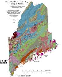
That blue clay we encountered near Kezar Lake seems to have been deposited during the last warming period around 11,000 years ago when meltwater was held back by an ice and debris dam and formed a much larger lake geologists call “Lake Pigwacket.” It was many times the size of what’s now Kezar Lake. All this surficial geology overlays bedrock, and it seems that Maine’s bedrock is among the most diverse on the entire planet — but that’s a column for another time.