

 |
| Promotion for Barrows' book on Fryeburg History 1938 |
Exactly two hundred years ago, a group of local farmers in Fryeburg, Maine changed the course of the Saco River with oxen and hand tools. First, however, they had to dig through bureaucratic red tape put in their path by Massachusetts government from which they requested help. Frustrated by that and the state’s refusal of funds, they dug a canal by themselves at their own expense. It was completed in 1820, the same year Maine finally broke from Massachusetts and became its own state.
 |
| North Fryeburg farmland today |
After rising near Crawford Notch in New Hampshire, the Saco River enters Maine in Fryeburg. Although the town is only about ten miles square, the Saco meanders through it for thirty-six miles. Early settlers cleared land and farmed, but the most fertile land in the northern part of town flooded nearly every spring. It was so bad, farmers petitioned the Massachusetts legislature (which governed Maine at the time) for flood relief in 1786. For the loss of a grist mill, nine houses, numerous animals, and much produce, Fryeburg was granted a tax abatement of 200 pounds.
 |
| Saco River today |
That was temporary relief and farmers wanted something permanent. They next petitioned the Massachusetts to fund a canal for flood control in 1812. They had a good idea about where and how to dig it because at one point near the center of town, the meandering courses of the river were only four-and-a-half miles apart. A canal there, through mostly sandy soil, would cut off seventeen miles of river through the fertile intervale in north Fryeburg. The plan was sound and would eventually relieve much of the flooding, but Massachusetts would not give them any money — only permission. So farmers wanted to dig it on their own.
 |
| More rich North Fryeburg farmland |
First, however, they had to indemnify themselves against legal liability for whatever damages their canal might cause, for along with state permission to form a corporation called “Proprietors of the Fryeburg(h) Canal,” the state attached — to both the corporation and three dozen individual proprietors — legal responsibility for damages in perpetuity. So, the farmers went back to the state in February, 1816 for relief of this endless liability. Massachusetts responded in June, 1816 by limiting it to four years. Only then did the farmers feel safe enough to break ground in earnest.
 |
| Old River upstream from Hemlock Bridge |
The sequence of actual construction is a bit confusing to this writer. One account said the digging of the first phase began in 1812; others say the digging began 1816 or 1817, but all agree the canal was finished in 1820 with the assistance of Mother Nature. It’s hard to say exactly where that construction started and some say it was done in segments over an eight-year period between 1812 and 1820. The most comprehensive account I have found so far is in John Stuart Barrow’s Fryeburg, Maine: An Historical Sketch published in 1938.
 |
| Fryeburg before canal showing two ponds in the center Library of Congress map |
There were two ponds within the four-and-a-half-mile stretch of land across which the canal was planned. One, called Bear Pond, was situated about where Canal Bridge crosses the present course of the river and it was completely drained by the canal. Nothing is left. The other, called Bog Pond, was larger and the canal drained most of it too, but a small segment remains to this day off Bog Pond Road between Route 5 and Menotomy Road.
 |
| Old Course of Saco near Hemlock Bridge |
According to former Fryeburg Historical Society President Diane Jones, the digging began behind what is now the Al Barton farm in West Fryeburg. She told me her late husband, Ed Jones, together with the late Phil Andrews, found what they believed was the beginning of the canal. None of the many accounts I read about or heard about contradict this. For those who said the first segment was dug between what is now the Old Course of the Saco and Bear Pond, the Jones/Andrews claim is as good as any about exactly where. I went down there last week, but vegetation is so thick in the many old oxbow riverbeds, I could see little. I’ll go back after leaf drop in the fall and check it out again.
 |
| Old Course of the Saco in Fryeburg Harbor |
Canal construction began with a narrow ditch — either in 1812 or in 1816 — and leading into Bear Pond. One account from Bill Vinton of Lovell said that a man could step across it in certain sections. Then came a freshet (river flooding) in 1820 that widened the ditch into the wider canal we see now and drained Bear Pond, then proceeded to Bog Pond and beyond to connect where the main course of the river below Hemlock Bridge now flows. Another account says there were two separate phases and the second phase was dug between the ponds a few years after the Bear Pond phase, and the 1820 freshet widened and deepened that part as well to complete the course of the Saco River as we know it today.
 |
| From Canal Bridge where Bear Pond used to be |
Today’s course is the river with a sandy bottom so many canoers enjoy. There’s little water left now in the Old Course of the Saco — which is what the 17 miles of river cut off by the canal has been called. There is more water where tributaries still flow in but not enough to use a canoe or kayak until the “Fryeburg Harbor” area where the Cold River flows in from Stow and the Kezar Lake outlet enters from Lovell. Even there the old river is slow-moving and choked with weeds, especially in late summer. Snapping turtles like it and they grow very large, but no one would want to float a tube or swim in it.
 |
| Winter dawn on today's Saco River |
Indians had traveled the winding Saco River in Fryeburg, possibly for nine thousand years or more. Archaeologists believe they farmed its fertile, intervale planting corn, beans, and squash beginning about three thousand years ago. In the late 20th century, amateur archaeologist Helen Leadbeater excavated two significant Indian settlements, one at Fryeburg Harbor and the other at Lovewell’s Pond. That pond is only a short canoe ride from the Saco as it flows south out of Fryeburg at the southern end end of town. She amassed her huge artifact collection primarily from these two sites.
 |
She also investigated the entire shore of Lovewell’s Pond and, based on the patterns of where she found artifacts, she surmised that Indians often portaged across a two-mile stretch of what is now Fryeburg Village from the Weston’s Bridge area to the northern shore of the pond. That shortcut would eliminate about two dozen miles of paddling through north Fryeburg for those traveling express from settlements in Conway, New Hampshire to other encampments along the river’s course all the way to its mouth in what is now Saco/Biddeford.
 |
| There are many different spellings of Pequawket |
The Pequawkets were part of a subgroup of Abenaki Indians called Sokokis who settled Fryeburg in historic times. They also included the Ossipee, after whom both the town in New Hampshire and a tributary of the Saco flowing from the Ossipee area are named. The Pequawkets and the Ossipee traveled up and down the rivers between the coast and the White Mountains regularly. Captain John Smith and Samuel Champlain both had contact with the Sokokis at the Saco River’s mouth in the early 1600s. The section of Maine’s Route 5 between the Fryeburg/Brownfield area and Saco, Maine is still called the “Sokokis Trail.”

The first white man thought to have entered what is now Fryeburg was likely Darby Field in 1642 on his way to Mount Washington. He described an Indian village of about two hundred and was probably referring to Pequawket — now Fryeburg. We know Captain John Lovewell arrived in 1725 from Dunstable, Massachusetts to fight Pequawket Indians at the pond named for him. Some historians claim Lovewell came to take Indian scalps, but other sources say he was retaliating for Pequawket raids into Dunstable and nearby Andover, Massachusetts. Lovewell died battling Indians in Fryeburg after which most of the Pequawkets retreated to St. Francis on the St Lawrence River.
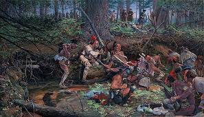 |
| John Buxton's "Ambush at Lovewell's Pond" |
The man destined to have the most impact on Fryeburg was Colonel Joseph Frye of Andover, after whom Fryeburg is named. A surveyor by trade, he knew of the fertile Saco intervale the Indians prized and persuaded the Province of Massachusetts to grant him the land in return for his service in the French and Indian War.
 |
| Cumberland and Oxford Canal |
During the late 1700s and early 1800s centuries there was a lot of canal digging in Maine and New England, mostly for two purposes: transportation and power. The Saco River canal for flood control was relatively unusual at the time. As it was completed though, a huge transportation canal project nearby was being planned called the Cumberland and Oxford Canal which was opened to traffic in 1832 from the outlet of Sebago Lake to Portland Harbor on the coast. Canals for water power were dug along the Androscoggin River in Lewiston for powering its textile mills.
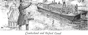
Back in the 1970s an older Lovell, Maine citizen told me how her grandfather shipped barrels of apples to England from Lovell in the 1800s. First he took them by wagon over the hills of Sweden, Maine to the northern tip of Long Lake in Harrison Village. There they were loaded onto specialized canal boats for transport down Long Lake, through the Songo Lock to Sebago Lake, then across it into the Cumberland and Oxford canal on the lake’s southern end. From there it was onward to inner Portland Harbor at Stroudwater.

There the apple barrels could be loaded onto ships bound for England, or they could remain on the specialized canal boats for transport along the Atlantic seaboard to the Port of Boston. These specialized canal boats were designed to drop a keel and erect two hinged masts, enabling travel along the coast in good weather.

When coal-driven steam power was introduced, however, both the power function and transportation function were gradually undermined. Steam power made railroads possible and they proved cheaper and faster than transporting goods by canal. Steam power also replaced water power for mills of all kinds: saw mills, grist mills, fulling mills, and textile mills. In Lewiston, water-driven turbines were replaced by steam turbines.
 |
| Recent shot of Saco at flood stage near Canal Bridge |
The Saco River was the biggest obstacle to travel between the old settlements of Fryeburg, Maine (1763) and Bethel, Maine (1769) over an Indian trail which, today, Route 5 largely follows. Bethel is located on the Androscoggin River; Fryeburg on the Saco. Indians preferred rivers for transportation, but they sometimes traveled overland between river systems. Excellent farmland on the intervales of both rivers which first drew Indians, then attracted Bethel’s and Fryeburg’s early white settlers, Colonel Frye being one of these.

Frye had fought Indians and their French Allies in 1757 at the Battle of Fort William Henry and elsewhere as commander of the Massachusetts Militia during the French and Indian War. For that, he obtained a land grant now comprising the town bearing his name. Like fellow French and Indian War Colonel George Washington, he was surveyor by trade. Both also became generals when the American Revolution broke out, but Frye, being much older, saw little service in it compared to Washington.
 |
| Joseph Frye cellar hole today |
It Massachusetts made its grant to Frye in 1762, he built his home in the center of town just above the Saco’s intervale. All that’s left of it now is a cellar hole in the woods at the end of a dirt road just off Route 5 north of the Fryeburg Fairgrounds. The road is marked by a brass plate set in a stone beside the paved highway. Frye knew the Saco intervale’s rich soil and huge potential for farming when he sought to acquire his land grant, but apparently not so much about the regularity of its annual floods and the bane they would be to farmers.

He soon learned after settling there himself but he died in 1794 before the canal was dug. He’s buried in the Village Cemetery but other members of his family lived to see the canal completed in 1820 — very close to his original home on Frye’s Hill. The Fryeburg canal stopped much of the flooding in north Fryeburg, but didn’t eliminate it entirely. I can remember twice that my brother Dan, when living on the McNeil Road in North Fryeburg at the edge of the intervale, had to use a canoe to get around for a few days.
3 comments:
Nice.
I'm still having a hard time wrapping my head around shipping apples in barrels by cart, then boat, then by AM+NOTHER boat and what it must have taken to pack them
(straw?) as well as ginger handling of the barrels.
I suspect rolling them was simply out of the question.
Now, who made the barrels that were never expected to be seen again?
I mean....I'm paying a $2.00 deposit for milk bottles 'fer cryin' out loud!
And I've seen mountains of used (once?) Fork lift pallets around other port cities.
Well Captain, the barrels were made locally. Farmers across the area would "make shook" in winter out of white oak. They called disassembled barrels "shook" because, local historian say, they'd pack the barrel staves and shake the package to settle them into smaller loads. Just about everything in the 19th century and earlier was shipped in barrels.
Your comment about not rolling barrels containing apples is thought-provoking. Don't know how they were packed in there but this old lady had old wooden barrels in her barn. Local blacksmiths must have made the metal hoops. Sometimes the staves were held together with wooden straps of ash too. There were barrels for dry goods and others for wet goods, which had to be more precisely fashioned.
There's very little white oak left around here because of the shook trade.
There were many different kinds of apples too. Some preserved longer than others and shipped better. There are efforts currently to preserve some rare apple trees because they're disappearing.
Post a Comment