


Remember digging a hole at the beach with your pail and shovel? It’s pretty easy to dig in sand when its grains are held together somewhat by moisture. Dig down far enough though and the hole fills with water. Then its sides collapse and you end up with a shallow depression. Well, that’s something like what we found when replacing a 35-year-old foundation that had been heaving up under a large garage on one of the properties I manage. First, we moved the garage off to the side. Then Colin Micklon and his crew at Micklon Tree and Landscaping dug out the old foundation which had been built on blue clay at the bottom of a hill near Kezar Lake.
 |
| Hitting blue clay |
Colin got down to an undisturbed level, or “virgin ground,” as it’s called in the trade. Then he set up a pump to suck out accumulating groundwater, trucked away all the fill, and got ready to build a crushed-stone base for the new foundation. Then a nor’easter arrived last month with all that rain. On top of groundwater from several springs in the hillside, it was too much and the blue-clay sides of the hole sloughed back in. While Colin and his crew dealt with that, I consulted my research materials to understand why the blue clay was there.

Whenever I see an excavator or backhoe digging, I pull over and look in the hole. It’s the only way to see what is under the surface, right? That’s basically what geologists do when compiling data on what they call Maine’s “surficial geology.” About fifteen ago I purchased several sets of data from the Maine Geological Survey (MGS) on Lovell and the surrounding area. The MGS arranges its research to correspond with green quadrangle maps from the United States Geological Survey (USGS) you’ve probably seen hanging up in various places.
 |
| USGS map Center Lovell Quadrangle |
My house is located on the southwest corner of the green map called the “Center Lovell Quadrangle.” Surrounding that are the Fryeburg Quadrangle, the Pleasant Mountain Quadrangle, the North Waterford Quadrangle, and so forth. I purchased those about forty years ago when I first moved to Lovell. I used them in my classroom to teach local geography, to guide me in my deer-hunting expeditions, and to explore cellar holes in abandoned settlements all around the area. The University of New Hampshire has an online collection of USGS Maps going back to the 1890s.
 |
Those maps are great for seeing what is on the surface like old logging roads, jeep trails, elevations, streams, and so forth, but don’t offer any information about what is under the surface. The Maine Geological Survey (MGS) surficial geology maps I purchased were based on data compiled up to 2002, but they’ve since been updated. Teams of state geologists visit each quadrangle periodically and look into whatever excavations are going on at the time, gravel pits, cellar holes, road cuts — wherever they can get peeks underground. They compare visible data with evolving theories about which of at least four ice sheets to have come and gone over this area during the past two million+ years did what.

After purchasing fourteen acres on Lovell’s Christian Hill back in 1980 or so, we began building the house in which we now live. First I cleared the trees, then hired Tommy Barker to dig the cellar hole. (Colin was in kindergarten then.) There’s only a foot or so of topsoil above what’s called “hardpan,” which goes about fifty feet down to bedrock. That, according to the above data, was laid down by a glacier, but which one? Was it the last one that melted back about 11,000 years ago? Or was it one the ice sheets that came and went before it hundreds of thousands of years earlier?

There were no geologists around to consult, but my guess is it was probably all of them. We know the last glacier best and it was estimated to be 1-2 miles thick and very heavy. It had boulders, sand, gravel, and clay contained within it which dropped wherever it melted. Earlier glaciers did the same. They all dropped material which was then compressed by the weight of subsequent glaciers. Maine’s hard pan is like concrete, extremely difficult to break through, and impermeable to water.
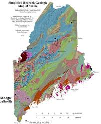
That blue clay we encountered near Kezar Lake seems to have been deposited during the last warming period around 11,000 years ago when meltwater was held back by an ice and debris dam and formed a much larger lake geologists call “Lake Pigwacket.” It was many times the size of what’s now Kezar Lake. All this surficial geology overlays bedrock, and it seems that Maine’s bedrock is among the most diverse on the entire planet — but that’s a column for another time.
2 comments:
Bedrock “diversity is our strength”.
Gosh, seems like a whole BUNCH of topography around ther is gouged from NW to SE, and a whole BUNCH of lakes and rivers (before meandering and ox-bowing, follow the ensuing texture, all the way to the ocean!
Seems like "Poland Spring water" can be had in an incredibly wide swath of geology.
Not on the surface of course.
Post a Comment